|
| |
|
Check Your Email for Date & Time of This Event!
ACA Members: emails should be in your in-box by Wednesday 11/9/2016
by 5:00 PM indicating date & time |
|
Status updated on Friday 11/18/2016 at 9:30 PM |
|
This event has been
CANCELLED
due to unfortunate weather conditions |
|
|
ACA Club Members Only
Observing Event
at
Salt Fork State Park
Let's hope for clear skies at one of Ohio's Dark Sky Sites
for a rare "Members-Only" observing night.
Driving directions and
embedded Google Map are below... |
|

|
Directions
to Salt Fork State Park,
14755 Cadiz Road, Lore City, OH 43755 |
|
1) Take I-77 South
to Exit 47
(near Cambridge, OH)
for US-22 toward Cambridge/Cadiz |
|
2)
Turn LEFT onto US-22
E/Cadiz Rd and continue for 6.5 miles |
|
3)
Turn LEFT onto R-1 (park road)
into Salt Fork State Park |
|
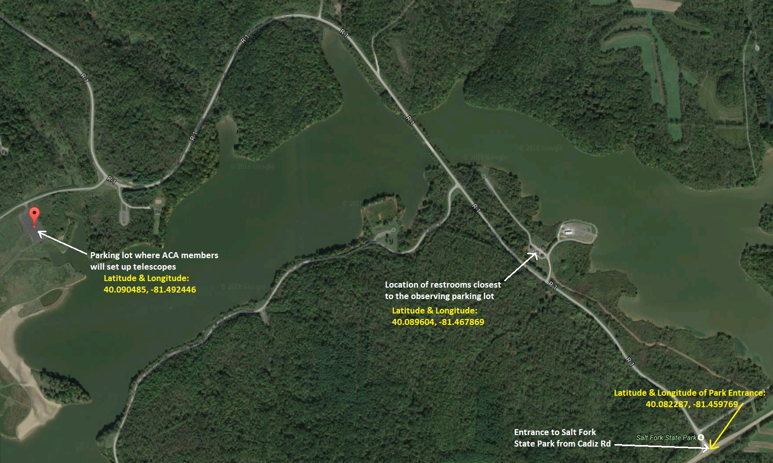
Directions
to Observing Location within Salt Fork State Park |
|
1)
Pull into park from
Cadiz
Rd |
|
2)
Follow curved R-1 park road for 2.3
miles and turn LEFT onto R-2 park road |
|
3)
Continue on R-2 for 0.2 miles
and turn LEFT into parking lot. You're there! |
|
To get
to Restrooms from the observing parking lot: |
|
1) Go back through the
parking lot and turn RIGHT on the R-2 park road |
|
2) Proceed for 0.2 miles and turn RIGHT onto
the R-1 park road |
|
3) Proceed 1.7 miles and turn LEFT onto R-16 park road
Restrooms are in the building in front of you. |
|
|
Latitude |
Longitude |
|
Park Entrance: |
40.082287
40° 4' 56" |
-81.459769
-81° 27' 35" |
|
Google Map |
|
Observing Site: |
40.090485
40° 5' 26" |
-81.492446
-81° 29' 33" |
|
Goggle Map |
|
Restrooms: |
40.089604
40° 5' 23" |
-81.467869
-81° 28' 4" |
|
Google Map |
|
|
|
|
Be
sure to hit the REFRESH / RELOAD button on your browser
(or the <F5> key on your keyboard) for up-to-date information |
Live Active Google Map:
Click
here
or on the map below to see a larger, more detailed map showing LATITUDE and
LONGITUDE data...

| |
Latitude |
Longitude |
|
Park Entrance: |
40.082287
40° 4' 56" |
-81.459769
-81° 27' 35" |
|
Google Map |
| Observing
Site: |
40.090485
40° 5' 26" |
-81.492446
-81° 29' 33" |
|
Goggle Map |
| Restrooms: |
40.089604
40° 5' 23" |
-81.467869
-81° 28' 4" |
|
Google Map |
.
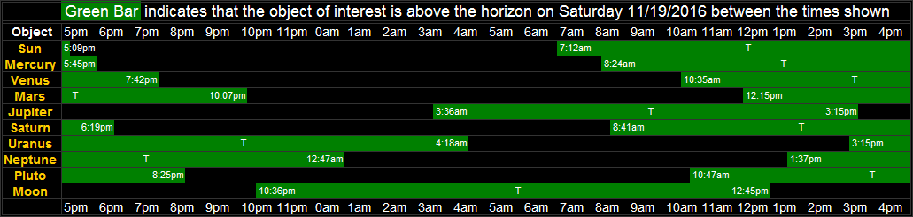
Solar System objects rise/transit/set times from
Salt Fork State Park on the date of this event... |
|
 |
|
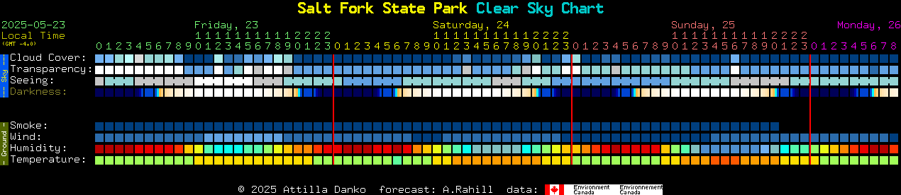
Live AccuWeather Satellite Mosaic |
|
 |
Jet Stream (updates
automatically to latest available image)
The Jet Stream affects astronomical "seeing" (steadiness of the air)
If
we're in a gray area, seeing will not be as good as in a white area.
If
we're in a white area, the shorter the arrows, the better.

|
![[Astronomy Club of Akron Logo]](../../images/Site_Content/aca.jpg)